"Greeley Panorama"
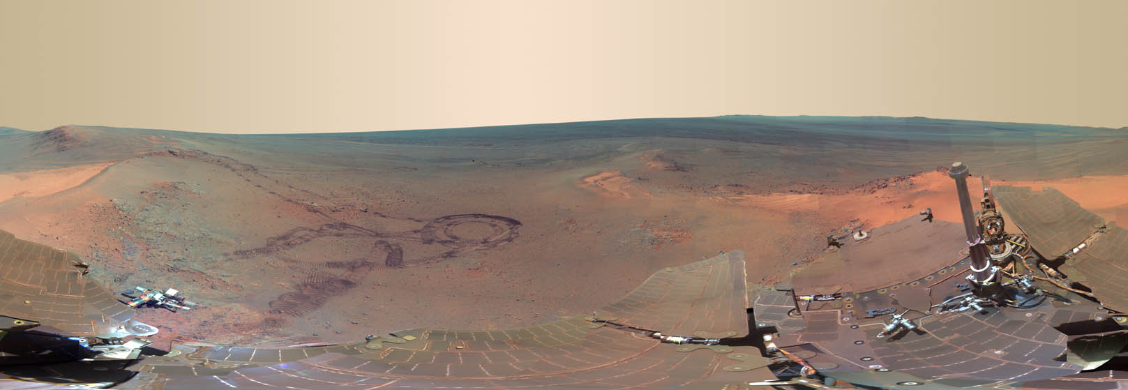
The Greeley Panorama is the result of four and a half months of imaging at Opportunity's winter location, Greeley Haven. The team chose the site for its Northerly tilt, to optimize solar gain during the winter months. The site's informal name is a tribute to the late Ronald Greeley, a geologist and former MER science team member.
During the acquisition of this panorama, Opportunity took advantage of its stationary position to do a number of other science experiments, including radio-science measurements to refine our knowledge of the interior of Mars, repeated observations of the atmosphere and surface, and investigations of the composition and textures of the outcrop in front of the rover.
Greeley Haven is located on Cape York, part of the Western rim of Endeavour Crater on Mars. In this image, the crater stretches from the center to the right side. Because the panorama shows a full 360 degrees, the rest of the crater can be seen on the left side. The tracks in the center reveal darker soil under a thin layer of bright dust. Stretching along the bottom of the image is the rover itself, distorted because of the type of projection used.
The Greeley Panorama is made up of 817 separate images taken by the Panoramic Camera (Pancam) between sols 2811 and 2947 (Dec. 21, 2011 and May 8, 2012). A false color view is presented to make certain differences between materials in the scene easier to see. Pancam's 753, 535, and 432 nanometer (L257) filters were used to create the Greeley Pan. A separate deck pan portion using Pancam's 601, 535, and 482 nanometer (L456) filters has been color balanced to match the L257 view and included in this mosaic.
Full resolution images available for download below.
Full Size JPG | Full Size TIFF
Image Dimensions: 23096x7981
Image credit: NASA/JPL-Caltech/Cornell/ASU
Image mosaicking: Jim Bell
Calibration and color rendering: CCC
and the Pancam team (Jim Bell, Jonathan Joseph)
Back to Panoramas