"Cahokia"
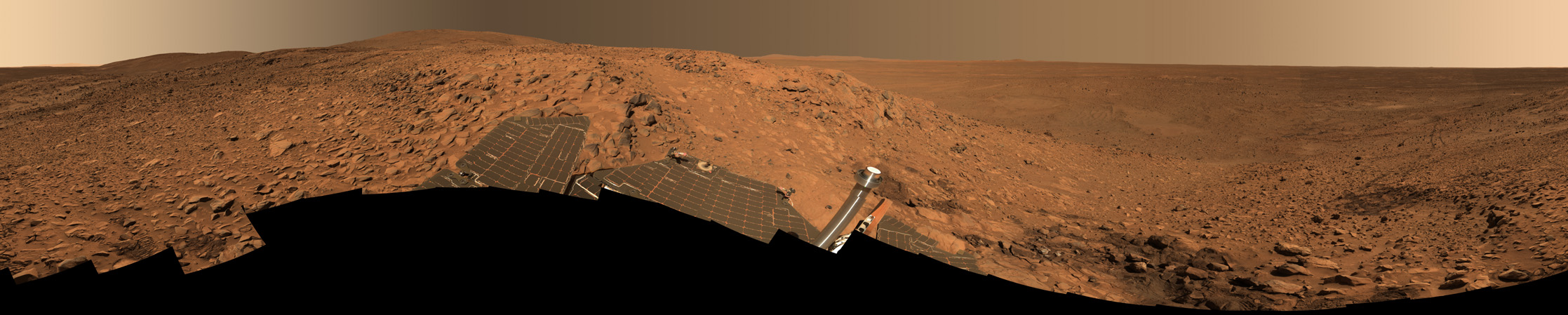
This stunning image mosaic of the "Columbia Hills" is the first 360-degree panorama taken since the Mars Exploration Rover Spirit arrived at the hills over a month ago. The rover has been busy studying the rocks here, which show evidence of past alteration by water. The dark patch of soil to the right is the spot where Spirit stopped for engineering work on its right front wheel. Spirit's tracks can be followed from there all the way back to "Bonneville Crater" and the original landing site, more than 3 kilometers (1.86 miles) away.
This approximate true-color image, nicknamed the "Cahokia panorama" after the Native American archaeological site near St. Louis, was acquired between sols 213 to 223 (Aug. 9 to 19, 2004). The panorama consists of 470 images acquired through six panoramic camera filters (750 to 480 nanometers). It took until the week of sol 237 (Sept. 2) to downlink all the data back to Earth. Several more weeks of image processing and geometric mapping by team members at Jet Propulsion Laboratory, Pasadena, Calif., and Cornell University, Ithaca, N.Y., were required to stitch all the images together into this spectacular mosaic.
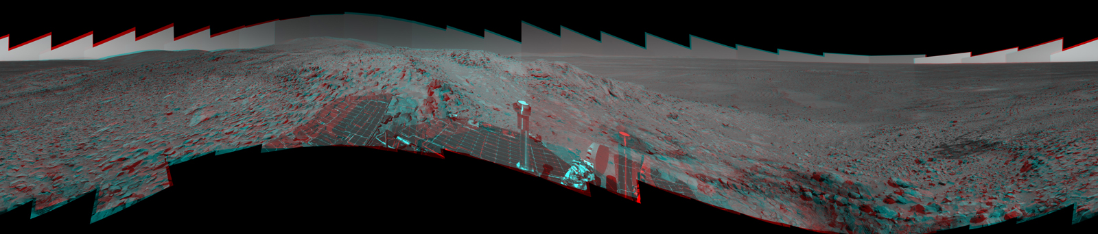
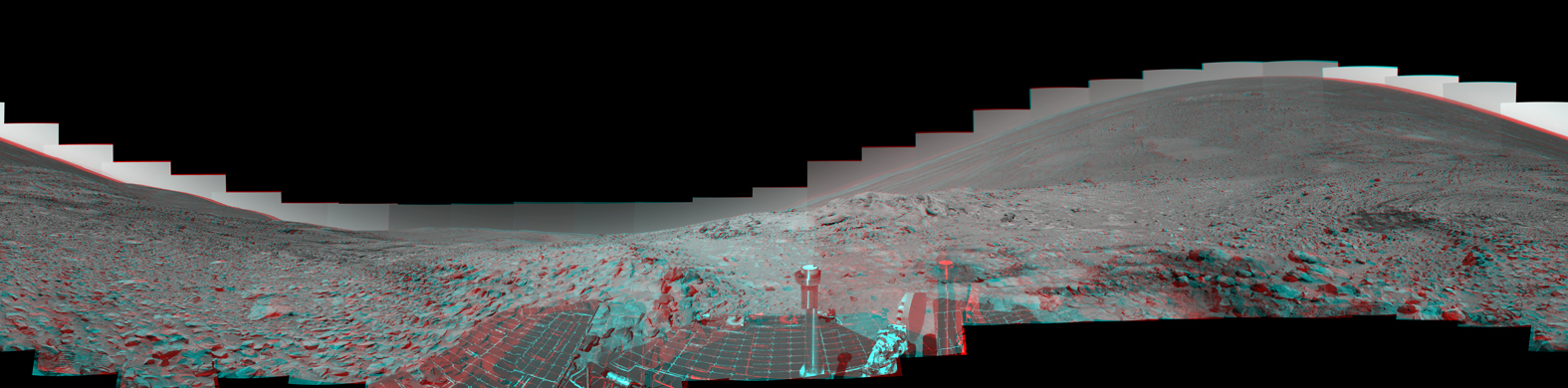
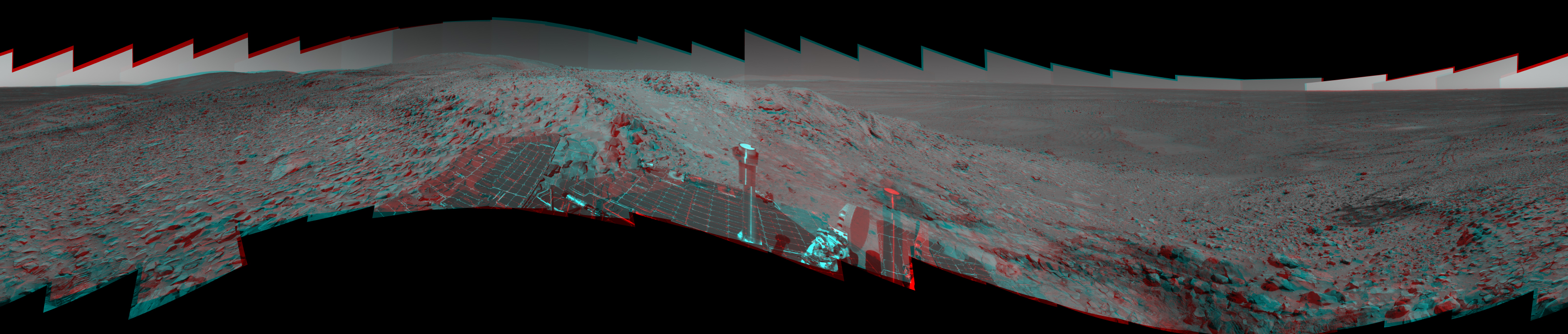
While at this location, Spirit used its panoramic camera to take a 360-degree stereo panorama of its surroundings. Because the rover was parked on a steep slope, it was tilted approximately 22 degrees to the west-northwest. Below are two different projections, one that compensates for the rover tilt, and one at the tilt angle. The first "tilt-adjusted"mosaic makes the martian horizon appear flat but also creates a vertical offset between the left and right eyes. This offset can make it difficult to view a scene like this looking through 3-D glasses because the two sides of the stereo image do not line up perfectly. Tilting your head one way or the other may help to view it more easily. In the second stereo image, the vertical alignment is nearly perfect, but the horizon appears to curve because of the rover's tilt. Both stereo views are presented in a cylindrical-perspective map projection with geometric seam correction.
Image credit: NASA/JPL/Cornell
Full Size JPG | Full Size TIFF
Image Dimensions: 22348x4487
Stereo image credit: JPL/MIPL (Bob Deen)
Stereo (tilt-adjusted) JPG
Image Dimensions: 3200x683
Stereo JPG
Image Dimensions: 26244x6500
Back to Panoramas